By EMELIE PEACOCK and GAIL SJUBERG
DRIFTWOOD STAFF
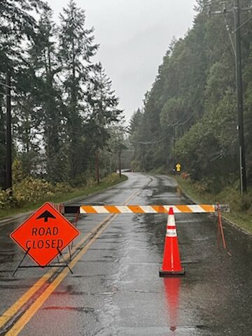
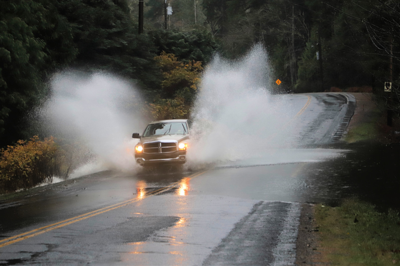
The main road connecting Ganges and Fulford is still closed as of 7 p.m. Monday following a massive rainstorm that flooded several roads on Salt Spring and resulted in damage to and closure of various roads.
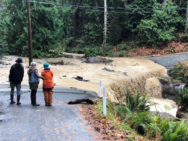
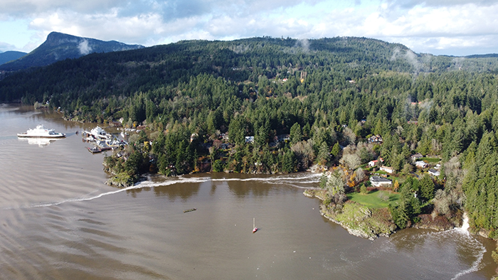
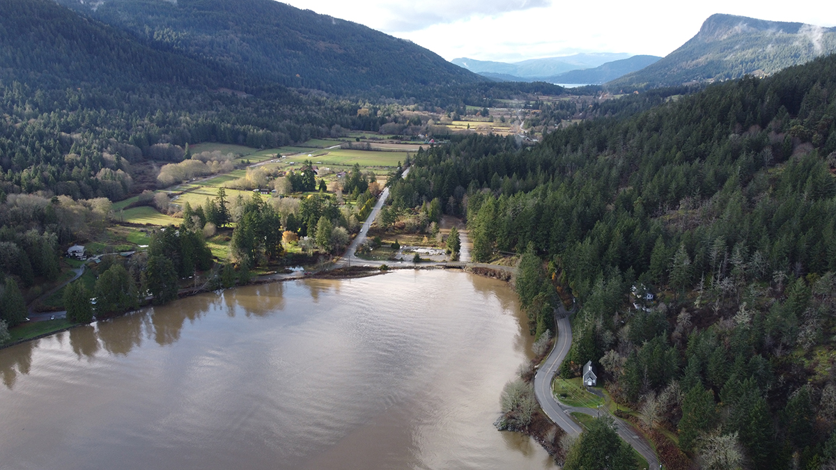
Water from an overflowing Blackburn Lake covered Fulford-Ganges Road on Monday, prompting the closure and requiring all traffic to use the Cusheon Lake, Stewart and Beaver Point roads route to connect Fulford and Ganges.
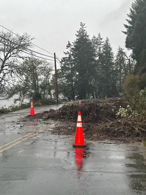
Isabella Point Road also experienced severe damage, and a mudslide occurred in the 1200 block of North End Road near St. Mary Lake, prompting closures in both spots. (See photos at the end of this article.)
The Environment Canada southern Gulf Islands weather station at Saturna Island measured 15.2 millimetres of rain on Saturday, and 59.4 mm on Sunday, both records for those dates since data was kept there (1980). Monday’s data is not yet available.
In addition to caution required while out driving, Salt Spring residents are being warned not to go into the water near the Ganges and Maliview wastewater treatment plants, after heavy rains caused water from the plants to flow into the ocean.
The impacted shorelines are near Gasoline Alley in Ganges and on the northeast of the island near the intersection of Maliview Drive and Walker’s Hook Road. The Capital Regional District (CRD) issued the warning Monday afternoon, stating that the treated and untreated wastewater “may pose a health risk.”
The water from the Ganges Wastewater Treatment Plant was partially treated wastewater that entered the stormwater system and discharged at the outlet of Ganges Creek. At the Maliview Estates Wastewater Treatment Plant, treated and untreated wastewater combined with storm water and entered the ocean through a discharge outfall pipe.
The CRD will be posting signage on affected beaches warning the public, until water test results show levels of enterococci, a bacteria found in fecal matter, below the recreational limit.
Neighbouring communities are also dealing with the same issue. Wastewater from Pender Island’s Schooner pump station flowed into the shoreline at Boat Nook on North Pender Island, prompting the CRD to issue a warning for residents not to go into the waters there. Water treatment plants and shoreline nearby them in Oak Bay, Saanich and Victoria are also experiencing the same issue of combined stormwater and wastewater flowing into the ocean.
BC Hydro also dealt with a power outage caused by a downed wire that affected 1,300 customers across the central and southwest parts of Salt Spring Island.
The weather also resulted in the Spirit of British Columbia ferry to Swartz Bay being held at Tsawwassen due to “adverse weather,” according to a notice from BC Ferries.
Heavy rainfall across southern B.C. has caused numerous washouts and mudslides as well as evacuation orders and alerts. The entire city of Merritt, with a population of over 7,000, has been ordered to evacuate due to flooding and a failure of the city’s wastewater system.
Several major highways between B.C.’s Interior and coast have been shut down, including the Coquihalla (Highway 5), Highway 1 and Highway 3. Along a stretch of Highway 7 between Hope and Agassiz an unknown number of people were trapped in their vehicles between two mudslides, with the CBC reporting that 80 to 100 vehicles affected.
Leader of the BC Greens Sonia Furstenau criticized the province for downloading the responsibility of informing the public of major storms like these to municipalities.
In a tweet that was retweeted by MLA for Saanich North and the Islands Adam Olsen, Furstenau stated these events need to be treated “for what they are — climate impacts that are only going to become more severe with time,” she wrote, calling for “urgent action and investments on climate risk preparedness and resiliency.”